Do You Have Aeronautical Survey requirement We Can Help With?

WHO WE ARE

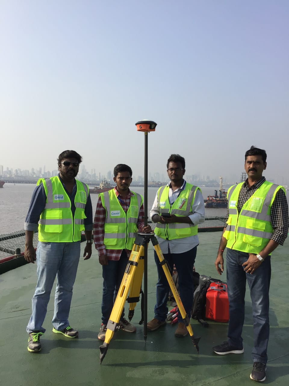
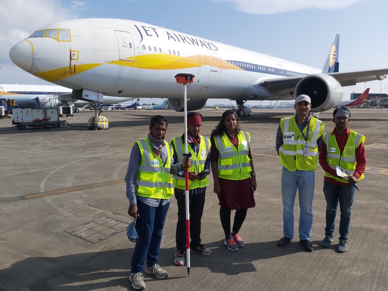
We are 10+ year old specialised professional Surveying & Mapping company based in Chennai, India, providing Complete GIS Solution to our clients with Airport Survey, Helipad Survey, Helideck Survey, Topography Survey, Mapping & GIS requirements. We use the ‘state of the art’ advanced technology dual frequency DGPS (Differential Global Positioning / GNSS System), Total Station, customized GIS solution. We offer our cost effective quality services to Government, Semi Government, Private Organizations & Corporates all over the globe, with high speed and best in class accuracy.

Surveying is at the core of what “GCPL” does. We began originally as a surveying-only firm and today that focus prevails in many of our projects, though we have expanded to many other areas of service. Our team consists of professional surveyors and skilled crews with the experience and knowledge to complete your project successfully.

WHAT WE DO

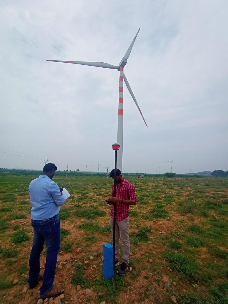
GCPL has been providing a full suite of geospatial services to support the varying data needs of our global clients. Today, Geoid Consultancy proudly offers NOC Survey for AAI/IAF, MOD Survey for Wind turbine /Solar Power Projects, Greenfield Airport Survey, Brownfield Airport Survey, OffShore Helideck Survey,Helipad Survey, photogrammetry, GIS and asset management, 3D scanning and Modeling and mobile solutions development. Additionally, We have wide network of business partners includes mobile mapping and LIDAR based data collection, flight procedure developers, and many other valyable skills. GCPL has proven to be a valuable team member on many projects in India and abroad.

We are empanelled Surveyors of Airports Authority of India (AAI) for conducting Aeronautical Survey of Airports belonging to AAI.

Meet Our Team

We are the sum of our collective passion, vision and expertise

K S Dhanasekar
K S DhanasekarFounder and Director
Dhanasekar is the Director and co-founder of GCPL. He has been a major driving factor in building the company from scratch and establishing GCPL as one of India’s leading GIS services companies. He leads from the front and ensures that the company is driven on high quality performance by the employees and also sustainable business strategies leading to positive outcomes. He continues working in the growth of GCPL with the same passion and motivation since the inception of GCPL.
K Priyadharshini
K PriyadharshiniProject Manager
Priyadharshini K is our company’s lead project manager and has been a prominent member of our company since it’s beginning. She holds a Master’s degree in Geoinformatics and is responsible for taking care of the entire project output. She also handles clients from public and private sector companies in International and Domestic domain with key emphasis in Survey, Mapping, ILS Procedure Design.
Suresh V
Suresh VAssociate Projects
Suresh V is one of our associate project managers who has been with GCPL for the past 6 years. He handles all of the automation software/tools for OLS survey and Aeronautical Charts Automation. He also helps in preparing software for Aerodrome Planning/Design, software for NOC and also for preparing charts that are required for OLS survey. He holds a Bachelor’s degree in Physics and Higher Diploma in Software Engineering.
R Vijayalakshmi
R VijayalakshmiManager Business Development and PR
Vijayalakshmi joined GCPL in 2018 as GIS Executive. She has been a part of GCPL for the past 3 years. Since then, she has handled several airports for OLS survey and take care of the NOC team independently. She has been one of the major reasons for bringing in more clients for NOC. She holds Master’s degree in Physics and PG Diploma in Spatial Technology.
Swathy Omprakash
Swathy OmprakashGIS Professional
Swathy Omprakash is our company’s leading GIS analyst with a master’s degree in Geoinformatics. Her major focus is on Airport survey, analyzing data accuracy and integrity. She also handles huge volumes of survey data collected during the obstacle analysis performed in various airports. She helps in preparing Aeronautical charts as per AAI Norms.
Elango J
Elango JManager - Survey and Mapping
Elango J is one of our Managers for Survey and Mapping. His major line of focus is airport survey, managing and assessing the survey data collected and also obstacles analysis. He also contributes in preparing aeronautical charts as per the AAI norms. He holds a Bachelors degree in Geoinformatics.
Sundaramoorthy M
Sundaramoorthy MManager - Survey and Mapping
Sundaramoorthy M is also one of our Managers for Survey and Mapping. His major line of focus is handling the clients and plans for conducting the OLS survey and efficient ways of data collection. He also handles our survey works conducted for the NOC certifications. He helps in preparing the OLS Survey charts and also NOC documents. He holds a Bachelor’s degree in Civil Engineering.
S Anandha Babu
S Anandha BabuManager - Survey and Mapping
Anandha Babu is one of our Managers for Survey and Mapping. His major line of focus is airport survey, managing and assessing the survey data collected and also obstacles analysis. He also contributes in preparing aeronautical charts as per the AAI norms. He holds a B.E Computer Science & IT.
C Prabakaran
C PrabakaranManager - Survey and Mapping
Prabakaran is one of our Managers for Survey and Mapping. His major line of focus is airport survey, managing and assessing the survey data collected and also obstacles analysis. He also contributes in preparing aeronautical charts as per the AAI norms. He holds a M.Sc Geoinformatics.
D Ravikumar
D RavikumarManager - Survey and Mapping
Ravikumar is one of our Managers for Survey and Mapping. His major line of focus is airport survey, managing and assessing the survey data collected and also obstacles analysis. He also contributes in preparing aeronautical charts as per the AAI norms. He holds a M.Sc Applied Geology & Geoinformatics.
A Abdul Mazid
A Abdul MazidAsst. Manager - Survey and Mapping
Abdul Mazid is one of our Asst. Manager for Survey and Mapping. His major line of focus are airport survey, Helideck survey, Helipad survey. Expert in managing and assessing the survey data collected and obstacles analysis. He also contributes in preparing aeronautical charts as per the AAI norms. He holds a Diploma in Civil Engineering.

Recent Works

Geoid Consultancy has been providing a full suite of geospatial services to support the varying data needs of our global clients. Today, Geoid Consultancy proudly offers NOC Survey for AAI/IAF, Greenfield Airport Survey, Brownfield Airport Survey,OffShore Helideck Survey,Helipad Survey, photogrammetry, GIS and asset management, software development, and mobile solutions development. Additionally, We have wide network of business partners includes mobile mapping and LIDAR based data collection, flight procedure developers, and many other vaulable skills. Geoid Consultancy has proven to be a valuable team member on many projects in India and abroad, below are just a few.

Expert Partners Agree

“Geoid Consultancy are very responsive to any requests, and get things done on time or sooner.
It is without reservation that I can recommend this firm for any project that has a GIS required component.”

Mr. Anil Ravat, GMR Group

“Geoid Consultancy has been a reliable and consistent partner in our projects. The Geoid Consultancy team’s responsiveness fits with our core values. The timely delivery by Geoid Consultancy has helped us meet our project deadline and reduced the stress on my group.  We continue to receive fast, friendly service, very accurate mapping at a very reasonable price.”

Mr. Ravi Shankar, Karnataka State Industrial & Infrastructure Development Corporation

Our Clients

Surveying is at the core of what “GCPL” does. We began originally as a surveying-only firm and today that focus prevails in many of our projects, though we have expanded to many other areas of service. Our team consists of professional surveyors and skilled crews with the experience and knowledge to complete your project successfully.

Get A Quote Today

Our professional staff includes engineer, and a customer retention expert. We have special expertise in NOC Survey, Airport Obstacle Survey,Airport Feasibility Survey,Topographic Survey and Mapping.