Do You Have Aeronautical Survey or NOC Survey Requirement We Can Help With?
EXPERTISE SURVEY & GIS SOLUTIONS
Surveying is an integral part of ‘GCPL’ array of service offerings. Our professional surveyors and skilled technicians consistently apply unique approaches using advanced surveying and technologies to provide quality and timely services to airport projects India & worldwide. Our services for aviation projects have ranged from small boundary surveys to comprehensive parcel maps for entire airports, obstruction surveys and from minor taxiway , topographic surveys to multi-phased, high definition surveys for runway replacement.
Our Vision is to Ensure that we provide our customers with high quality services in the most cost effective manner.
We are the sum of our collective passion, vision and expertise.
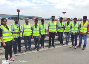
NOC Survey for the construction of high-rise buildings
We GCPL, are Airport’s Authority of India’s (AAI) empanelled survey agency. We undertake survey for obtaining NOC for height clearance from AAI / IAF, for constructing high raised buildings and skyscrapers.
For high-raised structures, such as buildings, masts, chimney and billboard etc. is around an existing or a proposed airport, an NOC from the AAI and/or defence authority (if it is a defence airport) is imperative.
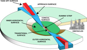
Airports Authority of India has introduced NOCAS, NO Objection Certificate Application System, to accept online applications for height clearance for the structures for Safeguarding the Airspace in and around the civil airports as per the rules laid down in GSR 751 (E), issued by MoCA on 30th September, 2015.
For the Defence Airports, responsibility is with the respective Defence Authorities.
We do an AMSL/RL survey with the help of DGPS and Total Station. The required Airport zoning map locating the proposed construction site is prepared by us. This map along with other drawings such as, site layout drawing, building elevation plan and other mandatory documents are obtained from the customer and the application is submitted to AAI, through AAI’s official web portal. In case of defence airport, the application is submitted to the concerned defence authority.

We do continue followup with the concerned authorities and assist the applicant to obtain the NOC. Thus we undertake the complete Liasioning for obtaining NOC for height clearance.
Thus in turn we assist in avoiding future obstacles to ensure a safe airspace.
We undertake NOC Appeal Cases
If any person or Local, Municipal or Town Planning and Development authorities
or any airport operator is aggrieved with the decision of the Designated officer,
such person or entity may appeal to the Appellate Committee for redressal of
his/their grievances with respect to the height permissible in Govt. notification
GSR 751(E) as amended by GSR 770(E)
We help in Documentation required for NOC Appeal Cases and Apply for Aeronautical Study if required.
NOC for Construction of Power Projects /WTGs/Solar Power projects
As per the Guidelines NOC for Construction of Power Projects/Wind Turbine Generators/Solar Power Projects (except solar power modules at the top of building for domestic usage) is required to be obtain from Ministry of Defence.
The NOC is proposed by various government agencies /autonomous bodies for Power projects and also by private agencies/individuals for private Power Projects . As per the existing procedure, applications for grant of NoC are forwarded by stakeholders ministry/organization to Ministry of Defence (MoD) for their recommendations. Bases on the inputs of the concerned authorities, the Ministry of Defence decides upon grant/refusal of NoC for such Power Projects.
The newly developed MoD web portal is aimed at facilitating the vendors for submission of applications online for grant of No Objection Certificate for Construction of Power Projects/Wind Turbine Generators/Solar Power Projects (except solar power modules at the top of building for domestic usage) . The automated/online system will help in reducing the time, bringing in more transparency, accuracy and speedy disposal of applications for grant of NoC by MoD . The latitude/ longitude for each of application should be clearly mentioned in application for ease in locating the items on ground.
We do MOD Survey /Prepare/Submit documents for Power Projects Wind Turbine/Solar Projects
We have done MOD survey for the clients
OSTRO KANNADA POWER PVT LTD
RENEW POWER
TATA POWER
NATIONAL INSTITUTE OF WIND ENERGY
AYANA RENEWABLE POWER PRIVATE LIMITED
Airport Obstacle Survey and Monitoring
Surveying is an integral part of ‘GCPL’ array of service offerings. Our professional surveyors and skilled technicians consistently apply unique approaches using advanced surveying and technologies to provide quality and timely services to airport projects India & worldwide. Our for aviation projects have ranged from small boundary surveys to comprehensive parcel maps for entire airports, obstruction surveys and from minor taxiway , topographic surveys to multi-phased, high definition surveys for runway replacement.
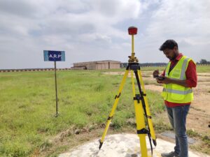
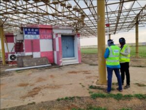
With an aviation focus, ‘GCPL’ surveying team has more than 10+ years of combined experience performing a wide range of surveying services at both general aviation and commercial service airports including procedure development, layout planning, geodetic control establishment (PACS/SACS), and obstacle assessment. Our experience ensures that no matter your project’s needs, ‘GCPL’ has the skills necessary to complete it successfully.
The surveys are conducted using WGS 84 Differential Global Positioning Systems (DGPS) with Airport control network established using the WGS-84 ellipsoid, Once this network is established, all airport runways and entities (NAV aids, lightings, etc.) are surveyed from the network station positions. All aerodrome obstacles will be referenced to the airport network. Report will be developed to contain all data required as per Airports Authority of India specification.
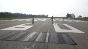
Airport Layout Planning
Our unique experience with surveying airport features, collecting critical data, and meeting the needs of airport Operators. our team has worked with a wide variety of airports to collect the facility data, topographic features, obstacles, through application of a wide-range of survey technologies.
Aeronautical Charts
Our team specializes in the development of ICAO mandated aeronautical charts for obstacles, including Type A and B, and the Aerodrome Grid Chart. We also prepare Aeronautical Survey Report, Airport Manual for Aerodrome operators/airport authorities with a need for cost-effective yet highly accurate charting solutions.
We prepare the following Aeronautical Charts
- Aerodrome Obstacle Chart-ICAO Type A
Aerodrome Obstacle Chart-ICAO Type B
Aerodrome Obstacle Chart-ICAO Type C
Precision Approach Terrain Chart-ICAO
En-route Chart-ICAO,
Approach Chart-ICAO,
Aerodrome Chart-ICAO
30 NM Chart
Aerodrome Ground Movement Chart-ICAO
Aircraft Parking / Docking Chart-ICAO
Area Chart-ICAO
Standard Departure Chart-Instrument (SID)-ICAO
Standard Arrival Chart-Instrument (STAR)-ICAO
Approach Chart
Visual Approach Chart-ICAO
Grid Map
Chart Showing various Obstacle Limitation Surfaces (OLS Chart) around an airport/Heliport.
Airport Feasibility Survey & Analysis
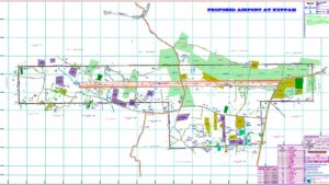
GCPL has the expertise in doing airport feasibility survey and analysis, for a green field, brown field airport. The proposed area with proposed runway orientation is studied with the OLS and an obstacle survey is conducted to accurately check the best location of the proposed runway. This is done with the help ESRI’s GIS software and our inhouse developed software.
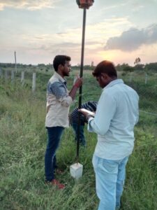
Topographic Survey
A Topographic Survey is a survey that gathers data about the elevation of points on a piece of land and presents them as contour lines on a plot. The purpose of a topographic survey is to collect survey data about the natural and man-made features of the land, as well as its elevations. Topographic maps are used to show elevations and grading features for architects, engineers, and building contractors.
GCPL’s professional land surveying team is well-versed in the nuances of topographic surveying. Utilizing the latest surveying technology, Our Professional surveyors produce accurate, consistently reliable topographic surveys, saving you both time and money during the construction process.
You can trust “GCPL” to provide all your land surveying needs promptly and professionally.

Charting
At GCPL we also prepare detailed topo map and contour map which helps client to take major decisions especially developing structure inside proposed airports.
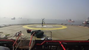
Obstacle Limitation Survey for Helideck/Helipad
We conduct OLS Survey for Existing/Proposed Helipad and Helideck as per ICAO / CAAP 437 standards.
This is basically a field survey and the data obtained after survey provides Helideck/Helipad geodetic control, TLOF, Visual aids,obstruction and other parameters that are critical to the Helicopter operations. The data were used for analysis like obstacle analysis, verification of Physical layout of helideck/Helipad, facilities design and prepare charts.
GCPL’s professional surveying team is well-versed in the nuances of Helideck/Helipad surveying. Utilizing the latest surveying technology, Our Professional surveyors produce accurate, consistently reliable Helideck/Helipad surveys, saving you both time and money during the construction process.
You can trust “GCPL” to provide all your surveying needs promptly and professionally.
Charting
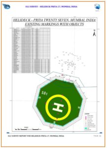
At GCPL we also prepare detailed Survey Report for Helideck/Helipad and Various Charts indicating Existing Layout/Proposed Layout which helps client to get the licensing easily from DGCA.
We undertake following services for Helipad Design/Construction
- HRP identification.
- Helipad Survey for the obstacles around 5 Kms radius from the HRP and report preparation.
- Application and Helipad SOP Manual preparation
- Helipad Lighting System for VFR & IFR Helipad.
- Helipad Fire Fighting System.
- Helipad Man Power Training.
- Helicopter Trial Landing.
ISSUE OF HELIPAD OPERATIONAL AUTHORIZATION UNDER REGIONAL CONNECTIVITY SCHEME (RCS)- Six Months duration minimum
Step -1: – Site Inspection and prefeasibility Report
Step -2: – Aeronautical (OLS) Survey (07 days) and OLS-Survey Report preparation (25 Days).
Step -3: – Clearances/Permissions from the following:
i. Ministry of Defense
ii. Ministry of Home Affairs through MoCA
iii. Ministry of Environment and Forests, Government of India, as applicable
iv. Airports Authority of India –ATM point of view, as applicable
v. Owner of the land
vi. Local authority such as Municipal Corporation or urban land development board/authority of the State or its Country and Town Planning Department.
Step -4: – Site Clearance for Heliport – The site may be inspected for its suitability by the DGCA officials. The applicant may be required to facilitate the inspecting officer(s) for such inspections.
Step -5: – Construction of Heliport – The applicant shall submit a project report / execution plan to the DGCA for acceptance.
Step -6: – Operational Authorization to Heliports under Regional Connectivity Scheme (RCS) – For issue of operational authorization the application shall be made with relevant information filled in the application along with the fee of Rs. One Lakh, including the applicable regulatory body’s clearances. The validity of Operational Authorization shall be 05 years.
Geographic Information System
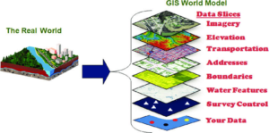
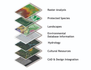
GCPL has highly trained GIS professionals who provide excellent GIS support and training on ArcGIS Platform. We understand the intricacies involved in surveying, and GIS development. More importantly, we have very good experience in molding our entire operation around the idea of producing a spatially accurate GIS base map. We understand every aspect of GIS design, including software and hardware requirements, to ensure the delivery of a suitable GIS base map and a user friendly GIS product.
Geographic Information Systems gives solutions to some about the queries relating to location, patterns, and trends.
GIS has helped so much in understanding climate change and remote sensing technology. Also, it helps in better evaluation of safety concerns using GIS such as understanding terrain slope and the probability of occurrence of an avalanche.
Applications of GIS in Real World
Archeology – GIS can identify more elements and characteristics of environmental science
Crime Statistics – Used to get automated and digital mapping of the crime scenes.
Civic Planning – Useful tool for rural and urban planning.
Health Resource Management – Maps are used to identify and manage health resources.
GIS is something that certainly makes many jobs easier and faster and allows them to do more things in the same space of time with the click of a button.
3D Scanning and Modeling
Working on a project requiring a 3D scanning? We’re there for you! Whether you need building scanning, we’re proud to offer all of our services to accommodate your needs no matter where your project is located.
A laser scanner will always produce a point cloud from which a 3D-model can be created should such be required. Both the point cloud and the 3D-model are georeferenced and to scale, making it possible to collect accurate measurements from within them. Point clouds are well suited to visualization and further processing, and can be delivered in LAS, PTS, or XYZ formats. The point clouds may contain intensity values or color values to create a more realistic visualization, if desired.
The point cloud is used to create a 3D-model, with the desired detail and BIM levels. This can be anything from large, rough constructions such as tunnel contours to small details like wall / façade decorations. Metadata can be attached to the digital objects, such as pipe type, manufacturer, feature code, post number, infrastructure type, and much, much more.
This makes the data very well suited for further processing in a BIM, CAD or GIS environment such as Revit, AutoCad or ArcGIS. Many modern tools provide the possibility of working with the information within this type of 3D-models, as well as using point clouds for visualization.
We have created 3D Model of Terminal Building T1D at Indira Gandhi International Airport. This will help L&T to construct cloning of Terminal Building.

AIRPORT DESIGN AND ENGINEERING SOLUTIONS
Our Clients
We have an array of clients from Government Organization, Public, Private Sector and across the Globe.
Location map of Projects completed
Get A Quote Today
Our professional staff includes engineer, and a customer retention expert. We have special expertise in NOC Survey, Airport Obstacle Survey,Airport Feasibility Survey,Topographic Survey and Mapping.


